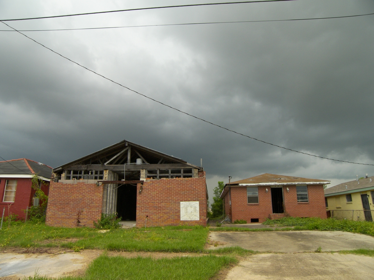
What follows is a photographic tour of the Bywater, St. Claude and Lower 9th Ward sections of New Orleans, now five years after the storm. Since the foundation of the city, New Orleans has always attracted the outsider’s judgmental gaze, usually directed towards a perceived laxity in morality. The laxity in this case seems to be municipal in nature–while ample demolitions have occurred, there is no presence of a revitalization scheme. Instead the city seems to nibble at the fringes providing minor streetscape improvements, token sewer inlets and the contractor’s dream, new sidewalks. All of this seems to occur without the guidance of a development plan. People I’ve talked to here roll their eyes at the outgoing Nagin administration but the problems are deeper. Unless someone takes a closer look at how to make these depopulated regions self-sustaining in both a residential and commercial sense, and to knit them back to the French Quarter-Marigny-CBD tourism nexus, no one will return nor will anyone invest. New Orleans has been redeveloping 4 of its 1940s-era public housing sites in accordance with essential New Urbanist tenets: creating a community of diverse incomes using context sensitive architecture and neighborhood amenities.
Because of the abundance of urban land, there are profound opportunities to rethink the grid, to concentrate new growth along new axes, to mix residential units with commercial properties and–perhaps most importantly–to create new bus or light rail connections to connect the 9th Ward. All of this is needed to graft the 9th Ward back into a city diced and quartered by race, class, infrastructural barriers, damage levels, and lack of coordinated reinvestment. [Look for a short post on these projects soon]
Elsewhere, further west closer to the whiter and younger Marigny, new opportunities are forming for a different set. Contractors are going back to work, gutting industrial buildings, creating new residences like the ‘Sugar Mill’.
Tour after the jump. [LOCATION OF PHOTOS]
 [4.-FROM THE INDUSTRIAL CANAL LEVEE LOOKING EAST.]
For full set of New Orleans photos with notes, click here.


The misspelling in the billboard pictured in photo no. 2 does not inspire confidence.
Well, this is a great post! A critic of new urbanism, Gilderbloom, suggested that the city invest in vernacular ‘shot-gun’ style housing, rather than Hope VI-ish mixed income / commercial models. Of course, this would risk concentrating development in low density residential over med/high density mixed-use, resulting in all sorts of spatial consequences. Gilderbloom cites as benefits: the ease and efficiency of building this sort of housing, homeownership and single family construction as social goods, and the pre-existing fabric of shot-gun low density construction. I’d be interested to know your thoughts on the merits of this suggestion.
Georgia: Entergy is an electricity provider.
Thank you for this post. We did a circuit near each of the 6 levee breaches in New Orleans just before the oil spill. In the lower 9th ward we saw scant redevelopment beyond Brad Pitt’s Potemkin village which rises out of the abondonned fields like an unanswered challenge to repopulate. There is a serious movement afoot to allow the lower 9th to revert to grassland and natural floodplain rather than force resettlement. I found myself sympathetic to this radical renaturing idea as we drove through block after block after block of empty streets. I think focusing efforts in the 7th around Treme would at this point make more sense. I look forward to further posts from your trip.